Curate, connect, and discover
Climate Change - Blog Posts

Sharpening Our View of Climate Change with the Plankton, Aerosol, Cloud, ocean Ecosystem Satellite
As our planet warms, Earth’s ocean and atmosphere are changing.
Climate change has a lot of impact on the ocean, from sea level rise to marine heat waves to a loss of biodiversity. Meanwhile, greenhouse gases like carbon dioxide continue to warm our atmosphere.
NASA’s upcoming satellite, PACE, is soon to be on the case!
Set to launch on Feb. 6, 2024, the Plankton, Aerosol, Cloud, ocean Ecosystem (PACE) mission will help us better understand the complex systems driving the global changes that come with a warming climate.

Earth’s ocean is becoming greener due to climate change. PACE will see the ocean in more hues than ever before.
While a single phytoplankton typically can’t be seen with the naked eye, communities of trillions of phytoplankton, called blooms, can be seen from space. Blooms often take on a greenish tinge due to the pigments that phytoplankton (similar to plants on land) use to make energy through photosynthesis.
In a 2023 study, scientists found that portions of the ocean had turned greener because there were more chlorophyll-carrying phytoplankton. PACE has a hyperspectral sensor, the Ocean Color Instrument (OCI), that will be able to discern subtle shifts in hue. This will allow scientists to monitor changes in phytoplankton communities and ocean health overall due to climate change.

Phytoplankton play a key role in helping the ocean absorb carbon from the atmosphere. PACE will identify different phytoplankton species from space.
With PACE, scientists will be able to tell what phytoplankton communities are present – from space! Before, this could only be done by analyzing a sample of seawater.
Telling “who’s who” in a phytoplankton bloom is key because different phytoplankton play vastly different roles in aquatic ecosystems. They can fuel the food chain and draw down carbon dioxide from the atmosphere to photosynthesize. Some phytoplankton populations capture carbon as they die and sink to the deep ocean; others release the gas back into the atmosphere as they decay near the surface.
Studying these teeny tiny critters from space will help scientists learn how and where phytoplankton are affected by climate change, and how changes in these communities may affect other creatures and ocean ecosystems.

Climate models are one of our most powerful tools to understand how Earth is changing. PACE data will improve the data these models rely on.
The PACE mission will offer important insights on airborne particles of sea salt, smoke, human-made pollutants, and dust – collectively called aerosols – by observing how they interact with light.
With two instruments called polarimeters, SPEXone and HARP2, PACE will allow scientists to measure the size, composition, and abundance of these microscopic particles in our atmosphere. This information is crucial to figuring out how climate and air quality are changing.
PACE data will help scientists answer key climate questions, like how aerosols affect cloud formation or how ice clouds and liquid clouds differ.
It will also enable scientists to examine one of the trickiest components of climate change to model: how clouds and aerosols interact. Once PACE is operational, scientists can replace the estimates currently used to fill data gaps in climate models with measurements from the new satellite.

With a view of the whole planet every two days, PACE will track both microscopic organisms in the ocean and microscopic particles in the atmosphere. PACE’s unique view will help us learn more about the ways climate change is impacting our planet’s ocean and atmosphere.
Stay up to date on the NASA PACE blog, and make sure to follow us on Tumblr for your regular dose of sPACE!

Six Answers to Questions You’re Too Embarrassed to Ask about the Hottest Year on Record
You may have seen the news that 2023 was the hottest year in NASA’s record, continuing a trend of warming global temperatures. But have you ever wondered what in the world that actually means and how we know?
We talked to some of our climate scientists to get clarity on what a temperature record is, what happened in 2023, and what we can expect to happen in the future… so you don’t have to!

1. Why was 2023 the warmest year on record?
The short answer: Human activities. The release of greenhouse gases like carbon dioxide and methane into the atmosphere trap more heat near Earth’s surface, raising global temperatures. This is responsible for the decades-long warming trend we’re living through.
But this year’s record wasn’t just because of human activities. The last few years, we’ve been experiencing the cooler phase of a natural pattern of Pacific Ocean temperatures called the El Niño Southern Oscillation (ENSO). This phase, known as La Niña, tends to cool temperatures slightly around the world. In mid-2023, we started to shift into the warmer phase, known as El Niño. The shift ENSO brought, combined with overall human-driven warming and other factors we’re continuing to study, pushed 2023 to a new record high temperature.

2. So will every year be a record now?
Almost certainly not. Although the overall trend in annual temperatures is warmer, there’s some year-to-year variation, like ENSO we mentioned above.
Think about Texas and Minnesota. On the whole, Texas is warmer than Minnesota. But some days, stormy weather could bring cooler temperatures to Texas while Minnesota is suffering through a local heat wave. On those days, the weather in Minnesota could be warmer than the weather in Texas. That doesn’t mean Minnesota is warmer than Texas overall; we’re just experiencing a little short-term variation.
Something similar happens with global annual temperatures. The globe will naturally shift back to La Niña in the next few years, bringing a slight cooling effect. Because of human carbon emissions, current La Niña years will be warmer than La Niña years were in the past, but they’ll likely still be cooler than current El Niño years.

3. What do we mean by “on record”?
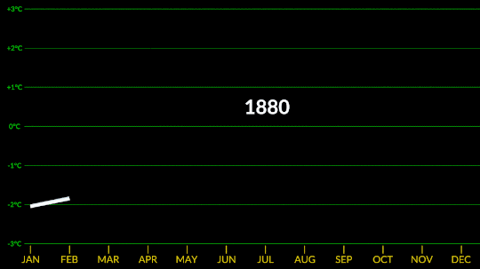
Technically, NASA’s global temperature record starts in 1880. NASA didn’t exist back then, but temperature data were being collected by sailing ships, weather stations, and scientists in enough places around the world to reconstruct a global average temperature. We use those data and our modern techniques to calculate the average.
We start in 1880, because that’s when thermometers and other instruments became technologically advanced and widespread enough to reliably measure and calculate a global average. Today, we make those calculations based on millions of measurements taken from weather stations and Antarctic research stations on land, and ships and ocean buoys at sea. So, we can confidently say 2023 is the warmest year in the last century and a half.

However, we actually have a really good idea of what global climate looked like for tens of thousands of years before 1880, relying on other, indirect ways of measuring temperature. We can look at tree rings or cores drilled from ice sheets to reconstruct Earth’s more ancient climate. These measurements affirm that current warming on Earth is happening at an unprecedented speed.
4. Why does a space agency keep a record of Earth’s temperature?
It’s literally our job! When NASA was formed in 1958, our original charter called for “the expansion of human knowledge of phenomena in the atmosphere and space.” Our very first space missions uncovered surprises about Earth, and we’ve been using the vantage point of space to study our home planet ever since. Right now, we have a fleet of more than 20 spacecraft monitoring Earth and its systems.
Why we created our specific surface temperature record – known as GISTEMP – actually starts about 25 million miles away on the planet Venus. In the 1960s and 70s, researchers discovered that a thick atmosphere of clouds and carbon dioxide was responsible for Venus’ scorchingly hot temperatures.

Dr. James Hansen was a scientist at the Goddard Institute for Space Studies in New York, studying Venus. He realized that the greenhouse effect cooking Venus’ surface could happen on Earth, too, especially as human activities were pumping carbon dioxide into our atmosphere.
He started creating computer models to see what would happen to Earth’s climate as more carbon dioxide entered the atmosphere. As he did, he needed a way to check his models – a record of temperatures at Earth’s surface over time, to see if the planet was indeed warming along with increased atmospheric carbon. It was, and is, and NASA’s temperature record was born.
5. If last year was record hot, why wasn’t it very hot where I live?
The temperature record is a global average, so not everywhere on Earth experienced record heat. Local differences in weather patterns can influence individual locations to be hotter or colder than the globe overall, but when we average it out, 2023 was the hottest year.
Just because you didn’t feel record heat this year, doesn’t mean you didn’t experience the effects of a warming climate. 2023 saw a busy Atlantic hurricane season, low Arctic sea ice, raging wildfires in Canada, heat waves in the U.S. and Australia, and more.

And these effects don’t stay in one place. For example, unusually hot and intense fires in Canada sent smoke swirling across the entire North American continent, triggering some of the worst air quality in decades in many American cities. Melting ice at Earth’s poles drives rising sea levels on coasts thousands of miles away.

6. Speaking of which, why is the Arctic – one of the coldest places on Earth – red on this temperature map?
Our global temperature record doesn’t actually track absolute temperatures. Instead, we track temperature anomalies, which are basically just deviations from the norm. Our baseline is an average of the temperatures from 1951-1980, and we compare how much Earth’s temperature has changed since then.
Why focus on anomalies, rather than absolutes? Let’s say you want to track if apples these days are generally larger, smaller, or the same size as they were 20 years ago. In other words, you want to track the change over time.
Apples grown in Florida are generally larger than apples grown in Alaska. Like, in real life, how Floridian temperatures are generally much higher than Alaskan temperatures. So how do you track the change in apple sizes from apples grown all over the world while still accounting for their different baseline weights?
By focusing on the difference within each area rather than the absolute weights. So in our map, the Arctic isn’t red because it’s hotter than Bermuda. It’s red because it’s gotten relatively much warmer than Bermuda has in the same time frame.
Want to learn more about climate change? Dig into the data at climate.nasa.gov.
Make sure to follow us on Tumblr for your regular dose of space!
Confirmed: Summer 2023 Hottest in NASA’s Record
All three months of summer 2023 broke records. July 2023 was the hottest month ever recorded, and the hottest July. June 2023 was the hottest June, and August 2023 was the hottest August.
NASA’s temperature record, GISTEMP, starts in 1880, when consistent, modern recordkeeping became possible. Our record uses millions of measurements of surface temperature from weather stations, ships and ocean buoys, and Antarctic research stations. Other agencies and organizations who keep similar global temperature records find the same pattern of long-term warming.
Global temperatures are rising from increased emissions of greenhouse gasses, like carbon dioxide and methane. Over the last 200 years, humans have raised atmospheric CO2 by nearly 50%, primarily through the burning of fossil fuels.
Drivers of climate change, both natural and human-caused, leave distinct fingerprints. Through observations and modeling, NASA researchers confirm that the current warming is the result of human activities, particularly increased greenhouse gas emissions.
NASA Inspires Your Crafty Creations for World Embroidery Day
It’s amazing what you can do with a little needle and thread! For #WorldEmbroideryDay, we asked what NASA imagery inspired you. You responded with a variety of embroidered creations, highlighting our different areas of study.
Here’s what we found:
Webb’s Carina Nebula

Wendy Edwards, a project coordinator with Earth Science Data Systems at NASA, created this embroidered piece inspired by Webb’s Carina Nebula image. Captured in infrared light, this image revealed for the first time previously invisible areas of star birth. Credit: Wendy Edwards, NASA. Pattern credit: Clare Bray, Climbing Goat Designs
Wendy Edwards, a project coordinator with Earth Science Data Systems at NASA, first learned cross stitch in middle school where she had to pick rotating electives and cross stitch/embroidery was one of the options. “When I look up to the stars and think about how incredibly, incomprehensibly big it is out there in the universe, I’m reminded that the universe isn’t ‘out there’ at all. We’re in it,” she said. Her latest piece focused on Webb’s image release of the Carina Nebula. The image showcased the telescope’s ability to peer through cosmic dust, shedding new light on how stars form.
Ocean Color Imagery: Exploring the North Caspian Sea

Danielle Currie of Satellite Stitches created a piece inspired by the Caspian Sea, taken by NASA’s ocean color satellites. Credit: Danielle Currie/Satellite Stitches
Danielle Currie is an environmental professional who resides in New Brunswick, Canada. She began embroidering at the beginning of the Covid-19 pandemic as a hobby to take her mind off the stress of the unknown. Danielle’s piece is titled “46.69, 50.43,” named after the coordinates of the area of the northern Caspian Sea captured by LandSat8 in 2019.

An image of the Caspian Sea captured by Landsat 8 in 2019. Credit: NASA
Two Hubble Images of the Pillars of Creation, 1995 and 2015

Melissa Cole of Star Stuff Stitching created an embroidery piece based on the Hubble image Pillars of Creation released in 1995. Credit: Melissa Cole, Star Stuff Stitching
Melissa Cole is an award-winning fiber artist from Philadelphia, PA, USA, inspired by the beauty and vastness of the universe. They began creating their own cross stitch patterns at 14, while living with their grandparents in rural Michigan, using colored pencils and graph paper. The Pillars of Creation (Eagle Nebula, M16), released by the Hubble Telescope in 1995 when Melissa was just 11 years old, captured the imagination of a young person in a rural, religious setting, with limited access to science education.

Lauren Wright Vartanian of the shop Neurons and Nebulas created this piece inspired by the Hubble Space Telescope’s 2015 25th anniversary re-capture of the Pillars of Creation. Credit: Lauren Wright Vartanian, Neurons and Nebulas
Lauren Wright Vartanian of Guelph, Ontario Canada considers herself a huge space nerd. She’s a multidisciplinary artist who took up hand sewing after the birth of her daughter. She’s currently working on the illustrations for a science themed alphabet book, made entirely out of textile art. It is being published by Firefly Books and comes out in the fall of 2024. Lauren said she was enamored by the original Pillars image released by Hubble in 1995. When Hubble released a higher resolution capture in 2015, she fell in love even further! This is her tribute to those well-known images.
James Webb Telescope Captures Pillars of Creation

Darci Lenker of Darci Lenker Art, created a rectangular version of Webb’s Pillars of Creation. Credit: Darci Lenker of Darci Lenker Art
Darci Lenker of Norman, Oklahoma started embroidery in college more than 20 years ago, but mainly only used it as an embellishment for her other fiber works. In 2015, she started a daily embroidery project where she planned to do one one-inch circle of embroidery every day for a year. She did a collection of miniature thread painted galaxies and nebulas for Science Museum Oklahoma in 2019. Lenker said she had previously embroidered the Hubble Telescope’s image of Pillars of Creation and was excited to see the new Webb Telescope image of the same thing. Lenker could not wait to stitch the same piece with bolder, more vivid colors.
Milky Way

Darci Lenker of Darci Lenker Art was inspired by NASA’s imaging of the Milky Way Galaxy. Credit: Darci Lenker
In this piece, Lenker became inspired by the Milky Way Galaxy, which is organized into spiral arms of giant stars that illuminate interstellar gas and dust. The Sun is in a finger called the Orion Spur.
The Cosmic Microwave Background

This image shows an embroidery design based on the cosmic microwave background, created by Jessica Campbell, who runs Astrostitches. Inside a tan wooden frame, a colorful oval is stitched onto a black background in shades of blue, green, yellow, and a little bit of red. Credit: Jessica Campbell/ Astrostitches
Jessica Campbell obtained her PhD in astrophysics from the University of Toronto studying interstellar dust and magnetic fields in the Milky Way Galaxy. Jessica promptly taught herself how to cross-stitch in March 2020 and has since enjoyed turning astronomical observations into realistic cross-stitches. Her piece was inspired by the cosmic microwave background, which displays the oldest light in the universe.

The full-sky image of the temperature fluctuations (shown as color differences) in the cosmic microwave background, made from nine years of WMAP observations. These are the seeds of galaxies, from a time when the universe was under 400,000 years old. Credit: NASA/WMAP Science Team
GISSTEMP: NASA’s Yearly Temperature Release

Katy Mersmann, a NASA social media specialist, created this embroidered piece based on NASA’s Goddard Institute for Space Studies (GISS) global annual temperature record. Earth’s average surface temperature in 2020 tied with 2016 as the warmest year on record. Credit: Katy Mersmann, NASA
Katy Mersmann is a social media specialist at NASA’s Goddard Space Flight Center in Greenbelt, Md. She started embroidering when she was in graduate school. Many of her pieces are inspired by her work as a communicator. With climate data in particular, she was inspired by the researchers who are doing the work to understand how the planet is changing. The GISTEMP piece above is based on a data visualization of 2020 global temperature anomalies, still currently tied for the warmest year on record.
In addition to embroidery, NASA continues to inspire art in all forms. Check out other creative takes with Landsat Crafts and the James Webb Space telescope public art gallery.
Make sure to follow us on Tumblr for your regular dose of space!

Ways NASA Studies the Ocean
We live on a water planet. The ocean covers a huge part of the Earth's surface – earning it the name Blue Marble.
The ocean is one of Earth’s largest ecosystems and helps moderate Earth’s climate. NASA scientists spend a lot of time studying the ocean and how it is changing as Earth’s climate changes.
In the last few years, NASA has launched an array of missions dedicated to studying this precious part of our planet, with more to come. For World Oceans Month, which starts in June, here are new ways NASA studies the ocean.
1. Seeing the colors of the ocean 🎨
A new NASA mission called PACE will see Earth’s oceans in more color than ever before. The color of the ocean is determined by the interaction of sunlight with substances or particles present in seawater.
Scheduled to launch in 2024, PACE will help scientists assess ocean health by measuring the distribution of phytoplankton, tiny plants and algae that sustain the marine food web. PACE will also continue measuring key atmospheric variables associated with air quality and Earth's climate.

2. Surveying surface water around the globe 💧
The SWOT satellite, launched in late 2022, is studying Earth’s freshwater – from oceans and coasts to rivers, lakes and more – to create the first global survey of Earth’s surface water.
SWOT is able to measure the elevation of water, observing how major bodies of water are changing and detecting ocean features. The data SWOT collects will help scientists assess water resources, track regional sea level changes, monitor changing coastlines, and observe small ocean currents and eddies.

3. Setting sail to understand interactions between the ocean and atmosphere 🚢
With research aircraft, a research ship, and autonomous ocean instruments like gliders, NASA’s S-MODE mission is setting sail to study Earth’s oceans up close. Their goal? To understand ocean whirlpools, eddies and currents.
These swirling ocean features drive the give-and-take of nutrients and energy between the ocean and atmosphere and, ultimately, help shape Earth’s climate.

4. Building ocean satellites the size of a shoebox 📦
NASA’s HawkEye instrument collects ocean color data and captures gorgeous images of Earth from its orbit just over 355 miles (575 kilometers) above Earth’s surface. It’s also aboard a tiny satellite measuring just 10cm x 10 cm x 30 cm – about the size of a shoebox!

5. Designing new missions to study Earth’s oceans! 🌊
NASA is currently designing a new space-based instrument called GLIMR that will help scientists observe and monitor oceans throughout the Gulf of Mexico, the southeastern U.S. coastline and the Amazon River plume that stretches to the Atlantic Ocean. GLIMR will also provide important information about oil spills, harmful algae blooms, water quality and more to local agencies.

6. Taking the ocean to new heights ⬆️
The U.S.-European Sentinel-6 Michael Freilich satellite is helping researchers measure the height of the ocean - a key component in understanding how Earth’s climate is changing.
This mission, which launched in 2020, has a serious job to do. It’s not only helping meteorologists improve their weather forecasts, but it’s helping researchers understand how climate change is changing Earth’s coastlines in real time.
Make sure to follow us on Tumblr for your regular dose of space!
Why Isn’t Every Year the Warmest Year on Record?
This just in: 2022 effectively tied for the fifth warmest year since 1880, when our record starts. Here at NASA, we work with our partners at NOAA to track temperatures across Earth’s entire surface, to keep a global record of how our planet is changing.
Overall, Earth is getting hotter.

The warming comes directly from human activities – specifically, the release of greenhouse gases like carbon dioxide from burning fossil fuels. We started burning fossil fuels in earnest during the Industrial Revolution. Activities like driving cars and operating factories continue to release greenhouse gases into our atmosphere, where they trap heat in the atmosphere.

So…if we’re causing Earth to warm, why isn’t every year the hottest year on record?
As 2022 shows, the current global warming isn’t uniform. Every single year isn’t necessarily warmer than every previous year, but it is generally warmer than most of the preceding years. There’s a warming trend.
Earth is a really complex system, with various climate patterns, solar activity, and events like volcanic eruptions that can tip things slightly warmer or cooler.
Climate Patterns
While 2021 and 2022 continued a global trend of warming, they were both a little cooler than 2020, largely because of a natural phenomenon known as La Niña.
La Niña is one third of a climate phenomenon called El Niño Southern Oscillation, also known as ENSO, which can have significant effects around the globe. During La Niña years, ocean temperatures in the central and eastern Pacific Ocean cool off slightly. La Niña’s twin, El Niño brings warmer temperatures to the central and eastern Pacific. Neutral years bring ocean temperatures in the region closer to the average.

El Niño and La Niña affect more than ocean temperatures – they can bring changes to rainfall patterns, hurricane frequency, and global average temperature.
We’ve been in a La Niña mode the last three, which has slightly cooled global temperatures. That’s one big reason 2021 and 2022 were cooler than 2020 – which was an El Niño year.
Overall warming is still happening. Current El Niño years are warmer than previous El Niño years, and the same goes for La Niña years. In fact, enough overall warming has occurred that most current La Niña years are warmer than most previous El Niño years. This year was the warmest La Niña year on record.

Solar Activity
Our Sun cycles through periods of more and less activity, on a schedule of about every 11 years. Here on Earth, we might receive slightly less energy — heat — from the Sun during quieter periods and slightly more during active periods.

At NASA, we work with NOAA to track the solar cycle. We kicked off a new one – Solar Cycle 25 – after solar minimum in December 2019. Since then, solar activity has been slightly ramping up.
Because we closely track solar activity, we know that over the past several decades, solar activity hasn't been on the rise, while greenhouse gases have. More importantly, the "fingerprints" we see on the climate, including temperature changes in the upper atmosphere, don't fit the what we'd expect from solar-caused warming. Rather they look like what we expect from increased greenhouse warming, verifying a prediction made decades ago by NASA.
Volcanic Eruptions
Throughout history, volcanoes have driven major shifts in Earth’s climate. Large eruptions can release water vapor — a greenhouse gas like carbon dioxide — which traps additional warmth within our atmosphere.
On the flip side, eruptions that loft lots of ash and soot into the atmosphere can temporarily cool the climate slightly, by reflecting some sunlight back into space.
Like solar activity, we can monitor volcanic eruptions and tease out their effect on variations in our global temperature.

At the End of the Day, It’s Us
Our satellites, airborne missions, and measurements from the ground give us a comprehensive picture of what’s happening on Earth every day. We also have computer models that can skillfully recreate Earth’s climate.
By combining the two, we can see what would happen to global temperature if all the changes were caused by natural forces, like volcanic eruptions or ENSO. By looking at the fingerprints each of these climate drivers leave in our models, it’s perfectly clear: The current global warming we’re experiencing is caused by humans.
For more information about climate change, visit climate.nasa.gov.
Make sure to follow us on Tumblr for your regular dose of space!
A Beginner’s Guide to Sustainable Aviation
Do you dream of catching a short flight between cities or journeying across the globe? The aviation industry currently makes up 2-3% of all carbon emissions, but the shift toward electric and hybrid aircraft will help tackle climate change and minimize the environmental impacts of commercial aviation.
Sustainable flight will revolutionize the way we travel. From battery-powered aircraft that reduce fuel consumption, to new lightweight materials that can improve safety and efficiency during flight, here are a few important things to know about the world of sustainable aviation, and what it takes to make air travel cleaner and safer for our planet.
What is Electrified Aircraft Propulsion?

Similar to electric or hybrid-electric cars, sustainable aircraft designs feature electric powertrain systems – the system of components that help propel an aircraft during flight – to help reduce fuel use and emissions. Electrified Aircraft Propulsion (EAP) systems let aircraft work using electric motors, and alternative fuels, rather than relying solely on traditional jet engines burning fossil fuels. At NASA, we’re developing innovative EAP technologies ranging from advanced electric machines designed to increase power and performance to new aircraft materials developed to minimize weight and reduce fuel usage.
What are the challenges with electrifying flight?


Unlike electric vehicles on the ground, electrified aircraft face greater challenges when managing weight and heat while they’re running. In order to ensure maximum efficiency and safety, aircraft components must be designed with minimal weight to help reduce the amount of drag slowing the plane down and causing excess fuel burn. Electrified aircraft must also have advanced thermal management systems to help transfer heat effectively, and ensure onboard systems are kept cool to avoid damage.
Our research and development of EAP technologies offer innovative solutions to these challenges. Designed to keep weight at a minimum, aircraft components such as the High Efficiency Megawatt Motor feature advanced technology that enable increased power and efficiency with three times less heat loss and weight than traditional aircraft motors. New material technologies such as electrical insulation also help transport heat more effectively to minimize heat buildup and are made of lightweight materials to ensure efficiency at high altitudes.
What are the benefits of sustainable aviation?

From an environmental perspective, aircraft electrification offers unique opportunities to lower global emissions and minimize reliance on fossil fuels. The introduction of hybrid- or fully electric aircraft will significantly reduce overall fuel consumption by generating power and thrust via electricity and electric motors. Lightweight EAP systems and components can also help improve aircraft efficiency and reduce fuel burn, while using non-conventional, alternative fuels can help reduce harmful emissions. From an economic standpoint, EAP technologies could help strengthen commercial airliner markets with aircraft designed for around 180 passengers. Green technologies can also benefit both airline companies and you when you fly by potentially reducing aircraft maintenance and in-flight energy costs, making air travel more affordable.
When will sustainable flight take off?

To help turn visions of eco-friendly air travel into reality, we’re teaming up with industry to test EAP technologies on aircraft and introduce them to the U.S. commercial aviation fleet no later than 2035.
Under our Electrified Powertrain Flight Demonstration (EPFD) project, we will conduct ground and flight tests using existing aircraft modified with EAP systems to assist in transitioning these technologies into commercial products. Flight demonstrations will also enable us to identify key risks and barriers associated with integrating new EAP systems into commercial airliners and develop new standards for future EAP aircraft as they take to the skies within the next decade.
There you have it: a quick glimpse into the world of sustainable aviation, and the shift towards keeping our skies cleaner and safer. As we embark on this journey, climb aboard and stay up to date on our latest technology developments and future flight demonstrations.
Make sure to follow us on Tumblr for your regular dose of space!
How Climate Change Showed Up in 2021
2021 was tied for the sixth-hottest year since modern record keeping began. We work together with the National Oceanic and Atmospheric Administration to track temperatures around the world and study how they change from year to year.

For decades, the overall global temperature has been increasing because of human activities. The last decade has been the warmest on record. Each individual year’s average temperature, however, can be affected by things like ocean circulation, volcanic eruptions, and specific weather events.
For instance, last year we saw the beginning of La Niña – a pattern of cooler waters in the Pacific – that was responsible for slightly cooling 2021’s average temperature. Still, last year continued a long-term trend of global warming.
Globally, Earth’s temperature in 2021 was nearly 2°F warmer than the late 19th Century, for the seventh year in a row.

The Record
Studying 142 Years
Since 1880, we can put together a consistent record of temperatures around the planet and see that it was much colder in the late-19th century. Before 1880, uncertainties in tracking global temperatures are larger. Temperatures have increased even faster since the 1970s, the result of increasing greenhouse gases in the atmosphere.
Tracking Millions of Individual Observations
Our scientists use millions of individual observations of data from more than 20,000 weather stations and Antarctic research stations, together with ship- and buoy-based observations of sea surface temperatures, to track global temperatures.

Reviewing Multiple Independent Records
Our global temperature record – GISTEMP – is one of a number of independent global temperature records, all of which show the same pattern of warming.

The Consequences
Everywhere Experiences Climate Change Differently
As Earth warms, temperature changes occur unevenly around the globe. The Arctic is currently warming about four times faster than the rest of the planet – a process called Arctic amplification. Similarly, urban areas tend to warm faster than rural areas, partly because building materials like asphalt, steel and concrete retain heat.

Droughts and Floods in Warmer Weather
More than 88% of the Western US experienced drought conditions in 2021. At the same time, communities in Western Europe saw two months’ worth of rain in 24 hours, breaking records and triggering flash floods. Because a hotter climate means more water can be carried in the atmosphere, areas like the Western US suffer drought from the increased 'thirstiness' of the atmosphere, while precipitation events can become more extreme as the amount of moisture in the atmosphere rises.

Sea Levels Continue to Rise
Melting ice raises sea levels around the world, as meltwater drains into the ocean. In addition, heat causes the ocean water to expand. From 1993 to today, global mean sea level has been rising around 3.4 millimeters per year. In 2021, sea level data from the recently launched NASA/ESA Sentinel-6 Michael Freilich mission became available to the public.

There is Hope
“This is not good news, but the fact that we are able to track this in real time and understand why it’s changing, and get people to notice why it’s changing and how we can change things to change the next trajectory, that gives me hope. Because we’re not in the dark here. We’re not the dinosaurs who are unaware the comet is coming. We can see the comet coming, and we can act.” – Dr. Gavin Schmidt, director of NASA GISS, where the global temperature record is calculated
Make sure to follow us on Tumblr for your regular dose of space!
Countdown to Launch of Landsat 9
We’re launching Landsat 9 — the ninth in a series of satellite missions from NASA and the U.S. Geological Survey (USGS) that have been collecting images of our planet for almost 50 years. Follow along as we count down to launch!

A normal launch countdown starts at 10, but for Landsat 9, we’re jumping in with L-9!
There are 9 million images in the USGS/NASA Landsat archive! They’re all available for free, for use by scientists, data managers, and anyone else who’s interested. You can even download them!

Landsat 9 won’t be orbiting alone. Working together, Landsat 9 and Landsat 8 will completely image Earth every 8 days! This helps us track changes on the planet’s surface as they happen in near-real-time.

Landsat sees all 7 continents! From Antarctic ice to growing cities to changing forests, Landsat measures land — and coastal regions — all around the globe.

Working in space is really hard. Landsat 6 never made it to orbit, an important reminder that failures can be opportunities to learn and grow. Shortly after the unsuccessful launch, engineers got to work on Landsat 7, which is still collecting data today — 22 years later.

We have 5 decades of Landsat observations, the longest continuous record of Earth’s land surfaces in existence! While building the original Landsat in the 1970s, it would have been hard to imagine that this mission would still be providing crucial data about our planet today.

For each color band collected, Landsat 9 will see 4 times the shades of light as the previous Landsat mission! With more than 16,000 different intensities detected, Landsat 9 will be able to see crucial details on our planet’s surface.

Our eyes detect 3 colors of light: red, green, and blue — and Landsat does too! But Landsat 9 also detects wavelengths that can be combined to measure things our eyes can’t, like crop stress, coral reef health, fires, and more.

There are 2 instruments on Landsat 9! The Operational Land Imager 2 collects light, and works kind of like our eyes — or cameras — to make data-rich images. The Thermal Infrared Sensor 2 measures temperature, helping monitor plant health, fires, and more.

The Landsat program is the result of 1 amazing partnership! For more than 50 years, we’ve worked with the U.S. Geological Survey to design, build, launch, and manage Landsat satellites.

Two agencies working together makes for the longest continuous record of Earth’s surfaces. Now, let’s launch this satellite!
Make sure to follow us on Tumblr for your regular dose of space!

NASA Spotlight: Earth Climate Scientist Dr. Yolanda Shea
Dr. Yolanda Shea is a climate scientist at NASA's Langley Research Center. She’s the project scientist for the CLARREO Pathfinder (CPF) mission, which is an instrument that will launch to the International Space Station to measure sunlight reflected from Earth. It will help us understand how much heat is being trapped by our planet’s atmosphere. Her mission is designed to help us get a clearer picture than we currently have of the Earth’s system and how it is changing
Yolanda took time from studying our home planet to answer questions about her life and career! Get to know this Earth scientist:
What inspired you to study climate science?
Starting in early middle school I became interested in the explanations behind the weather maps and satellite images shown on TV. I liked how the meteorologists talked about the temperature, moisture, and winds at different heights in the atmosphere, and then put that together to form the story of our weather forecasts. This made me want to learn more about Earth science, so I went to college to explore this interest more.
The summer after my junior year of college, I had an internship during which my first assignment was to work with a program that estimated ocean currents from satellite measurements. I was fascinated in the fact that scientists had discovered a way to map ocean currents from space!
Although I had learned about Earth remote sensing in my classes, this was my first taste of working with, and understanding the details of, how we could learn more about different aspects of the physical world from satellite measurements.
This led to my learning about other ways we can learn about Earth from space, and that includes rigorous climate monitoring, which is the area I work in now.

What does a day in your life look like?
Before I start my workday, I like to take a few minutes to eat breakfast, knit (I’m loving sock knitting right now!), and listen to a podcast or audio book. Each workday really looks different for me, but regardless, most days are a combination of quieter moments that I can use for individual work and more interactive times when I’m interfacing with colleagues and talking about project or science issues. Both types of work are fun in different ways, but I’m glad I have a mixture because all researchers need that combination of deep thinking to wrap our minds around complex problems and also time to tackle those problems with others and work on solving them together.
When do you feel most connected to Earth?
I’ve always loved sunsets. I find them peaceful and beautiful, and I love how each one is unique. They are also a beautiful reminder of the versatility of reflected light, which I study. Sitting for a moment to appreciate the beauty and calm I feel during a sunset helps me feel connected to Earth.

What will your mission – CLARREO Pathfinder – tell us about Earth?
CLARREO Pathfinder (CPF) includes an instrument that will take measurements from the International Space Station and will measure reflected sunlight from Earth. One of its goals is to demonstrate that it can take measurements with high enough accuracy so that, if we have such measurements over long periods of time, like several decades, we could detect changes in Earth’s climate system. The CPF instrument will do this with higher accuracy than previous satellite instruments we’ve designed, and these measurements can be used to improve the accuracy of other satellite instruments.
How, if at all, has your worldview changed as a result of your work in climate science?
The longer I work in climate science and learn from the data about how humans have impacted our planet, the more I appreciate the fragility of our one and only home, and the more I want to take care of it.

What advice would you give your younger self?
It’s ok to not have everything figured out at every step of your career journey. Work hard, do your best, and enjoy the journey as it unfolds. You’ll inevitably have some surprises along the way, and regardless of whether they are welcome or not, you’re guaranteed to learn something.
Do you have a favorite metaphor or analogy that you use to describe what you do, and its impact, to those outside of the scientific community?
I see jigsaw puzzles as a good illustration of how different members of a science community play a diverse set of roles to work through different problems. Each member is often working on their own image within the greater puzzle, and although it might take them years of work to see their part of the picture come together, each image in the greater puzzle is essential to completing the whole thing. During my career, I’ll work on a section of the puzzle, and I hope to connect my section to others nearby, but we may not finish the whole puzzle. That’s ok, however, because we’ll hand over the work that we’ve accomplished to the next generation of scientists, and they will keep working to bring the picture to light. This is how I try to think about my role in climate science – I hope to contribute to the field in some way; the best thing about what I have done and what I will do, is that someone else will be able to build on my work and keep helping humanity come to a better understanding of our Earth system.
What is a course that you think should be part of required school curriculum?
Time and project management skills – I think students tend to learn these skills more organically from their parents and teachers, but in my experience I stumbled along and learned these skills through trial and error. To successfully balance all the different projects that I support now, I have to be organized and disciplined, and I need to have clear plans mapped out, so I have some idea of what’s coming and where my attention needs to be focused.
Another course not specifically related to my field is personal financial management. I was interested in personal finance, and that helped me to seek out information (mainly through various blogs) about how to be responsible with my home finances. There is a lot of information out there, but making sure that students have a solid foundation and know what questions to ask early on will set them to for success (and hopefully fewer mistakes) later on.

What’s the most unexpected time or place that your expertise in climate science and/or algorithms came in handy?
I think an interesting part of being an atmospheric scientist and a known sky-watcher is that I get to notice beautiful moments in the sky. I remember being on a trip with friends and I looked up (as I usually do), and I was gifted with a gorgeous sundog and halo arc. It was such a beautiful moment, and because I noticed it, my friends got to enjoy it too.

Can you share a photo or image from a memorable NASA project you’ve worked on, and tell us a little bit about why the project stood out to you?
I absolutely loved being on the PBS Kids TV Show, SciGirls for their episode SkyGirls! This featured a NASA program called Students’ Clouds Observations On-Line (S’COOL). It was a citizen science program where students from around the globe could take observations of clouds from the ground that coincided with satellite overpasses, and the intention was to help scientists validate (or check) the accuracy of the code they use to detect clouds from satellite measurements. I grew up watching educational programming from PBS, so it was an honor to be a science mentor on a TV show that I knew would reach children across the nation who might be interested in different STEM fields. In this photo, the three young women I worked with on the show and I are talking about the different types of clouds.
To stay up to date on Yolanda's mission and everything going on in NASA Earth science, be sure to follow NASA Earth on Twitter and Facebook.
🌎 If you're looking for Earth Day plans, we have live events, Q&As, scavenger hunts and more going on through April 24. Get the details and register for our events HERE.
Make sure to follow us on Tumblr for your regular dose of space: http://nasa.tumblr.com.
6 Ways NASA is Involved in Climate Science
When it comes to climate change, we play a unique role in observing and understanding changes to the planet. Thanks to NASA’s Earth observations and related research, we know our planet and its climate are changing profoundly. We also know human activities, like releasing carbon dioxide and methane into the atmosphere, are driving this change.
Not only do we make these observations, we help people and groups use this knowledge to benefit society. The work we do at NASA is critical to helping us understand the ways our planet is responding to increased temperatures.

Here are 6 ways that we are involved in climate science and informing decisions:
1. Monitoring Earth’s vital signs
Just like a doctor checks your vitals when you go in for a visit, here at NASA we are constantly monitoring Earth’s vital signs - carbon dioxide levels, global temperature, Arctic sea ice minimum, the ice sheets and sea level, and more.

We use satellites in space, observations from airplanes and ships, and data collected on the ground to understand our planet and its changing climate. Scientists also use computers to model and understand what's happening now and what might happen in the future.

People who study Earth see that the planet’s climate is getting warmer. Earth's temperature has gone up more than 1 degree Celsius (~2 degrees Fahrenheit) in the last 100 years. This may not seem like much, but small changes in Earth's temperature can have big effects. The current warming trend is of particular significance, because it is predominantly the result of human activity since the mid-20th century and is proceeding at an unprecedented rate.

People drive cars. People heat and cool their houses. People cook food. All those things take energy. Human-produced greenhouse gas emissions are largely responsible for warming our planet. Burning fossil fuels -- which includes coal, oil, and natural gas -- releases greenhouse gases such as carbon dioxide into the atmosphere, where they act like an insulating blanket and trap heat near Earth’s surface.
At NASA, we use satellites and instruments on board the International Space Station to confirm measurements of atmospheric carbon levels. They’ve been increasing much faster than any other time in history.

2. Tracking global land use and its impacts
We also monitor and track global land use. Currently, half the world's population lives in urban areas, and by 2025, the United Nations projects that number will rise to 60%.

With so many people living and moving to metropolitan areas, the scientific world recognizes the need to study and understand the impacts of urban growth both locally and globally.

The International Space Station helps with this effort to monitor Earth. Its position in low-Earth orbit provides variable views and lighting over more than 90% of the inhabited surface of Earth, a useful complement to sensor systems on satellites in higher-altitude polar orbits. This high-resolution imaging of land and sea allows tracking of urban and forest growth, monitoring of hurricanes and volcanic eruptions, documenting of melting glaciers and deforestation, understanding how agriculture may be impacted by water stress, and measuring carbon dioxide in Earth’s atmosphere.
3. Research into the causes of climate change
Being able to monitor Earth’s climate from space also allows us to understand what’s driving these changes.

With the CERES instruments, which fly on multiple Earth satellites, our scientists measure the Earth’s planetary energy balance – the amount of energy Earth receives from the Sun and how much it radiates back to space. Over time, less energy being radiated back to space is evidence of an increase in Earth’s greenhouse effect. Human emissions of greenhouse gases are trapping more and more heat.

NASA scientists also use computer models to simulate changes in Earth’s climate as a result of human and natural drivers of temperature change.

These simulations show that human activities such as greenhouse gas emissions, along with natural factors, are necessary to simulate the changes in Earth’s climate that we have observed; natural forces alone can’t do so.
4. Research into the effects of climate change
Global climate change has already had observable effects on the environment. Glaciers and ice sheets have shrunk, ice on rivers and lakes is breaking up earlier, plant and animal ranges have shifted, and trees are flowering sooner.

The effects of global climate change that scientists predicted are now occurring: loss of sea ice, accelerated sea level rise and longer, more intense heat waves.
Climate modelers have predicted that, as the planet warms, Earth will experience more severe heat waves and droughts, larger and more extreme wildfires, and longer and more intense hurricane seasons on average. The events of 2020 are consistent with what models have predicted: extreme climate events are more likely because of greenhouse gas emissions.

Plants are also struggling to keep up with rising carbon dioxide levels. Plants play a key role in mitigating climate change. The more carbon dioxide they absorb during photosynthesis, the less carbon dioxide remains trapped in the atmosphere where it can cause temperatures to rise. But scientists have identified an unsettling trend – 86% of land ecosystems globally are becoming progressively less efficient at absorbing the increasing levels of carbon dioxide from the atmosphere.
Helping organizations to use all the data and knowledge NASA generates is another part of our job. We’ve helped South Dakota fight West Nile Virus, helped managers across the Western U.S. handle water, helped The Nature Conservancy protect land for shorebirds, and others. We also support developing countries as they work to address climate and other challenges through a 15-year partnership with the United States Agency for International Development.
5. Action on sustainability
Sustainability involves taking action now to enable a future where the environment and living conditions are protected and enhanced. We work with many government, nonprofit, and business partners to use our data and modeling to inform their decisions and actions. We are also working to advance technologies for more efficient flight, including hybrid-electric propulsion, advanced materials, artificial intelligence, and machine learning.

These advances in research and technology will not only bring about positive changes to the climate and the world in which we live, but they will also drive the economic engine of America and our partners in industry, to remain the world-wide leader in flight development.
We partner with the private sector to facilitate the transfer of our research and NASA-developed technologies. Many innovations originally developed for use in the skies above help make life more sustainable on Earth. For example:
Our Earth-observing satellites help farmers produce more with less water.
Expertise in rocket engineering led to a technique that lessens the environmental impact of burning coal.
A fuel cell that runs equipment at oil wells reduces the need to vent greenhouse gases.
6. Applying climate research to preserve NASA centers in coastal areas
Sea level rise in the two-thirds of Earth covered by water may jeopardize up to two-thirds of NASA's infrastructure built within mere feet of sea level.

Some NASA centers and facilities are located in coastal real estate because the shoreline is a safer, less inhabited surrounding for launching rockets. But now these launch pads, laboratories, airfields, and testing facilities are potentially at risk because of sea level rise. We’ve worked internally at NASA to identify climate risks and support planning at our centers.
NASA Climate Science
Climate change is one of the most complex issues facing us today. It involves many dimensions – science, economics, society, politics, and moral and ethical questions – and is a global problem, felt on local scales, that will be around for decades and centuries to come. With our Eyes on the Earth and wealth of knowledge on the Earth’s climate system and its components, we are one of the world’s experts in climate science.
Visit our Climate site to explore and learn more.
Make sure to follow us on Tumblr for your regular dose of space: http://nasa.tumblr.com
One Hot Year after Another
Globally, 2020 was the hottest year on record, effectively tying 2016, the previous record. Overall, Earth’s average temperature has risen more than 2 degrees Fahrenheit since the 1880s.

Temperatures are increasing due to human activities, specifically emissions of greenhouse gases, like carbon dioxide and methane.
Heat and the energy it carries are what drive our planet: winds, weather, droughts, floods, and more are expressions of heat. The right amount of heat is even one of the things that makes life on Earth possible. But too much heat is changing the way our planet’s systems act.
My World’s on Fire
Higher temperatures drive longer, more intense fire seasons. As rain and snowfall patterns change, some regions are getting drier and more vulnerable to damage, setting the stage for more fires.

2020 saw several record-breaking fires, both in Australia in the beginning of the year, and in the western U.S. through northern summer and fall. Smoke from fires in both regions reached so high into the atmosphere that it formed clouds and continues to travel around the globe today.

In the Siberian Arctic, unusually high temperatures helped drive at least 19 fires in the region. More than half of them were burning peat soil -- decomposed organic materials -- that stores a lot of carbon. Peat fires release vast amounts of carbon into the atmosphere, potentially leading to even more warming.

The Water’s Getting Warm
It wasn’t just fire seasons setting records. 2020 had more named tropical storms in the Atlantic and more storms making landfall in the U.S. than any hurricane season on record.

Hurricanes rely on warm ocean water as fuel, and this year, the Atlantic provided. 30 named storms weren’t the only things that made this year’s hurricane season notable.

Storms like Eta, Delta, and Iota quickly changed from smaller, weaker tropical storms into more destructive hurricanes. This rapid intensification is complicated, but it’s likely that warmer, more humid weather -- a result of climate change -- helps drive it.

The Ice Is Getting Thin
Add enough heat, and even the biggest chunk of ice will melt. That’s true whether we’re talking about the ice cubes in your glass or the vast sheets of ice at our planet’s poles. Right now, the Arctic region is warming about three times faster than the rest of our planet, which has some major effects both locally and globally.

This year, Arctic sea ice hit a near-record low. Sea ice is actually made of frozen ocean water, and it grows and thaws with the seasons, typically reaching an annual minimum extent in September.

Warmer ocean water led to more ice melting this year, and 2020’s annual minimum extent continued a long trend of shrinking Arctic sea ice extent.
A Long Trend
We study Earth and how it’s changing from the ground, the sky, and space. Using data from sensors all around the planet, we calculate the global average temperature, working with our partners at NOAA.
Many other organizations also track global temperature using their own instruments and methods, and they all match remarkably well. The last seven years were the hottest seven years on record. Earth is getting warmer.

We also study the effects of increasing temperatures, like the melting sea ice and longer fire seasons mentioned above. Additionally, we can study the cause of climate change from space, with a bird’s eye view of increasing carbon in the atmosphere.

The planet is changing because of human activities. We’re working together with other agencies to monitor changes and understand what this means for people in the future.
Make sure to follow us on Tumblr for your regular dose of space: http://nasa.tumblr.com.
Rocket Launches and Rising Seas
At NASA, we’re not immune to effects of climate change. The seas are rising at NASA coastal centers – the direct result of warming global temperatures caused by human activity. Several of our centers and facilities were built near the coast, where there aren’t as many neighbors, as a safety precaution. But now the tides have turned and as sea levels rise, these facilities are at greater risk of flooding and storms.

Global sea level is increasing every year by 3.3 millimeters, or just over an eighth of an inch, and the rate of rise is speeding up over time. The centers within range of rising waters are taking various approaches to protect against future damage.

Kennedy Space Center in Florida is the home of historic launchpad 39A, where Apollo astronauts first lifted off for their journey to the Moon. The launchpad is expected to flood periodically from now on.

Like Kennedy, Wallops Flight Facility on Wallops Island, Virginia has its launchpads and buildings within a few hundred feet of the Atlantic Ocean. Both locations have resorted to replenishing the beaches with sand as a natural barrier to the sea.

Native vegetation is planted to help hold the sand in place, but it needs to be replenished every few years.

At the Langley Research Center in Hampton, Virginia, instead of building up the ground, we’re hardening buildings and moving operations to less flood-prone elevations. The center is bounded by two rivers and the Chesapeake Bay.
The effects of sea level rise extend far beyond flooding during high tides. Higher seas can drive larger and more intense storm surges – the waves of water brought by tropical storms.

In 2017, Hurricane Harvey brought flooding to the astronaut training facility at Johnson Space Center in Houston, Texas. Now we have installed flood resistant doors, increased water intake systems, and raised guard shacks to prevent interruptions to operations, which include astronaut training and mission control.

Our only facility that sits below sea level already is Michoud Assembly Facility in New Orleans. Onsite pumping systems protected the 43-acre building, which has housed Saturn rockets and the Space Launch System, from Hurricane Katrina. Since then, we’ve reinforced the pumping system so it can now handle double the water capacity.

Ames Research Center in Silicon Valley is going one step farther and gradually relocating farther south and to several feet higher in elevation to avoid the rising waters of the San Francisco Bay.
Understanding how fast and where seas will rise is crucial to adapting our lives to our changing planet.

We have a long-standing history of tracking sea level rise, through satellites like the TOPEX-Poseidon and the Jason series, working alongside partner agencies from the United States and other countries.

We just launched the Sentinel-6 Michael Freilich satellite—a U.S.-European partnership—which will use electromagnetic signals bouncing off Earth’s surface to make some of the most accurate measurements of sea levels to date.
Make sure to follow us on Tumblr for your regular dose of space: http://nasa.tumblr.com.
Earth’s Land Ice by the Numbers
“At a glacial pace” used to mean moving so slowly the movement is almost imperceptible. Lately though, glaciers are moving faster. Ice on land is melting and flowing, sending water to the oceans, where it raises sea levels.

In 2018, we launched the Ice, Cloud and Land Elevation Satellite-2 (ICESat-2) to continue a global record of ice elevation. Now, the results are in. Using millions of measurements from a laser in space and quite a bit of math, researchers have confirmed that Earth is rapidly losing ice.

16 Years
ICESat-2 was a follow-up mission to the original ICESat, which launched in 2003 and took measurements until 2009. Comparing the two records tells us how much ice sheets have melted over 16 years.

½ Inch
During those 16 years, melting ice from Antarctica and Greenland was responsible for just over a half-inch of sea level rise. When ice on land melts, it eventually finds its way to the ocean. The rapid melt at the poles is no exception.

400,000 Olympic Swimming Pools
One gigaton of ice holds enough water to fill 400,000 Olympic swimming pools. It’s also enough ice to cover Central Park in New York in more than 1,000 feet of ice.

200 Gigatons
Between 2003 and 2019, Greenland lost 200 gigatons of ice per year. That’s 80 million Olympic swimming pools reaching the ocean every year, just from Greenland alone.

118 Gigatons
During the same time period, Antarctica lost 118 gigatons of ice per year. That’s another 47 million Olympic swimming pools every year. While there has been some elevation gain in the continent’s center from increased snowfall, it’s nowhere near enough to make up for how much ice is lost to the sea from coastal glaciers.

10,000 Pulses
ICESat-2 sends out 10,000 pulses of laser light a second down to Earth’s surface and times how long it takes them to return to the satellite, down to a billionth of a second. That’s how we get such precise measurements of height and changing elevation.

These numbers confirm what scientists have been finding in most previous studies and continue a long record of data showing how Earth’s polar ice is melting. ICESat-2 is a key tool in our toolbox to track how our planet is changing.
Make sure to follow us on Tumblr for your regular dose of space: http://nasa.tumblr.com.
Are there any parts of the Earth still left unexplored?
Looking 50 Years in the Future with NASA Earth Scientists
In the 50 years since the first Earth Day, the view from space has revolutionized our understanding of Earth’s interconnected atmosphere, oceans, freshwater, ice, land, ecosystems and climate that have helped find solutions to environmental challenges.
If NASA’s Earth science has changed this much in 50 years, what will it look like in 50 more years?
We asked some researchers what they thought. Here are their answers, in their own words.

Mahta Moghaddam is a professor of electrical and computer engineering at the University of Southern California. She’s building a system that helps sensors sync their measurements.
I am interested in creating new ways to observe the Earth. In particular, my team and I are building and expanding a system that will allow scientists to better study soil moisture. Soil moisture plays a vital role in the water and energy cycle and drives climate and weather patterns. When soil is wet and there is enough solar radiation, water can evaporate and form clouds, which precipitate back to Earth. Soil also feeds us – it nourishes our crops and sustains life on Earth. It’s one of the foundations of life! We need to characterize and study soil in order to feed billions of people now and in the future.

Our novel tool aims to observe changes in soil moisture using sensors that talk to each other and make decisions in real time. For instance, if one sensor in a crop field notes that soil is dry in a plot, it could corroborate it with other sensors in the area and then notify a resource manager or decision maker that an area needs water. Or if a sensor in another location senses that soil moisture is changing quickly due to rain or freeze/thaw activity, it could send a command to launch a drone or even to notify satellites to start observing a larger region. We live in one big, connected world, and can and will use many different scales of observations – local to global – from point-scale in-situ sensors to the scales that can be covered by drones, airplanes, and satellites. In just a few years from now, we might see much more vastly automated systems, with some touching not only Earth observations, but other parts of our lives, like drone deliveries of medical tests and supplies.

Odele Coddington is a scientist at the Laboratory for Atmospheric and Space Physics at the University of Colorado, Boulder. She’s building an instrument to measure how much solar energy Earth reflects back into space.
My research is focused on the Earth system response to the Sun’s energy. I spend half of my time thinking about the amount and variability of the Sun’s energy, also known as the solar irradiance. I’m particularly interested in the solar spectral irradiance, which is the study of the individual wavelengths of the Sun’s energy, like infrared and ultraviolet. On a bright, clear day, we feel the Sun’s warmth because the visible and infrared radiation penetrate Earth’s atmosphere to reach the surface. Without the Sun, we would not be able to survive. Although we’ve been monitoring solar irradiance for over 40 years, there is still much to learn about the Sun’s variability. Continuing to measure the solar irradiance 50 years from now will be as important as it is today.

I spend the other half of my time thinking about the many processes driven by the Sun’s energy both within the atmosphere and at the surface. I’m excited to build an instrument that will measure the integrated signal of these processes in the reflected solar and the emitted thermal radiation. This is my first foray into designing instrumentation and it has been so invigorating scientifically. My team is developing advanced technology that will measure Earth’s outgoing radiation at high spatial resolution and accuracy. Our instrument will be small from the onset, as opposed to reducing the size and mass of existing technology. In the future, a constellation of these instruments, launched on miniaturized spacecraft that are more flexible to implement in space, will give us more eyes in the sky for a better understanding of how processes such as clouds, wildfires and ice sheet melting, for instance, alter Earth’s outgoing energy.

Sujay Kumar is a research physical scientist at NASA’s Goddard Space Flight Center. He works on the Land Information System.
Broadly, I study the water cycle, and specifically the variability of its components. I lead the development of a modeling system called the Land Information System that isolates the land and tries to understand all the processes that move water through the landscape. We have conceptual models of land surface processes, and then we try to constrain them with satellite data to improve our understanding. The outputs are used for weather and climate modeling, water management, agricultural management and some hazard applications.

I think non-traditional and distributed platforms will become more the norm in the future. So that could be things like CubeSats and small sats that are relatively cheaper and quicker than large satellites in terms of how much time it takes to design and launch. One of the advantages is that because they are distributed, you’re not relying on a single satellite and there will be more coverage. I also think we’ll be using data from other “signals of opportunity” such as mobile phones and crowd-sourced platforms. People have figured out ways to, for example, retrieve Earth science measurements from GPS signals.
I feel like in the future we will be designing our sensors and satellites to be adaptive in terms of what the observational needs on the ground are. Say a fire or flood happens, then we will tell the satellite to look over there more intensely, more frequently so that we can benefit. Big data is a buzzword, but it’s becoming a reality. We are going to have a new mission call NISAR that’s going to collect so much data that we really have to rethink how traditional modeling systems will work. The analogy I think of is the development of a self-driving car, which is purely data driven, using tons and tons of data to train the model that drives the car. We could possibly see similar things in Earth science.
Hear from more NASA scientists on what they think the future will bring for Earth science:
Make sure to follow us on Tumblr for your regular dose of space: http://nasa.tumblr.com.
2019 Temperature By the Numbers
The Year
2nd Hottest
2019 was the second-hottest year since modern record keeping began. NASA and the National Oceanic and Atmospheric Administration work together to track temperatures around the world and study how they change from year to year. For decades, the overall global temperature has been increasing.

Over the long term, world temperatures are warming, but each individual year is affected by things like El Niño ocean patterns and specific weather events.
The global temperature is an average, so not every place on Earth had its second-warmest year. For instance, the continental U.S. had a cold October, but Alaska set records for high temperatures. The U.S. was still warmer than average over the year.
Globally, Earth’s temperature in 2019 was more than 2°F warmer than the late 19th Century.
The Record
140 years
Since 1880, we can put together a consistent record of temperatures around the planet and see that it was much colder in the late-19th century. Before 1880, uncertainties in tracking global temperatures are larger. Temperatures have increased even faster since the 1970s, the result of increasing greenhouse gases in the atmosphere.

10 years
The last decade was the hottest decade on record.

20,000 Individual Observations
Scientists from NASA use data from more than 20,000 weather stations and Antarctic research stations, together with ship- and buoy-based observations of sea surface temperatures to track global temperatures.

The Consequences
90%
As Earth warms, polar ice is melting at an accelerated rate. The Arctic is warming even faster than the rest of the planet. This northern summer, 90% of the surface of the Greenland Ice Sheet melted.

8 inches
Melting ice raises sea levels around the world. While ice melts into the ocean, heat also causes the water to expand. Since 1880, sea levels globally have risen approximately 8 inches, although regional rates of sea level rise can be even higher.

100+ fires
As temperatures increase, fire seasons burn hotter and longer. During June and July 2019, more than 100 long-lived and intense wildfires burned north of the Arctic circle. This year also saw intense, record-setting fires in Australia.


46% increase in CO2 levels
This decades-long warming trend is the result of increasing greenhouse gases in the atmosphere, released by human activities.

Make sure to follow us on Tumblr for your regular dose of space: http://nasa.tumblr.com
Moving at the Speed of Arctic Ice
Time-lapses taken from space can help track how Earth’s polar regions are changing, watching as glaciers retreat and accelerate, and ice sheets melt over decades.

Using our long data record and a new computer program, we can watch Alaskan glaciers shift and flow every year since 1972. Columbia Glacier, which was relatively stable in the 1970s, has since retreated rapidly as the climate continues to warm.

The Malaspina Glacier has pulsed and spread and pulsed again. The flashes and imperfect frames in these time-lapses result from the need for cloud-free images from each year, and the technology limitations of the early generation satellites.

In Greenland, glaciers are also reacting to the warming climate. Glaciers are essentially frozen rivers, flowing across land. As they get warmer, they flow faster and lose more ice to the ocean. On average, glaciers in Greenland have retreated about 3 miles between 1985 and 2018. The amount of ice loss was fairly consistent for the first 15 years of the record, but started increasing around 2000.

Warmer temperatures also affect Greenland farther inland, where the surface of ice sheets and glaciers melts, forming lakes that can be up to 3 miles across. Over the last 20 years, the number of meltwater lakes forming in Greenland increased 27% and appeared at higher elevations, where temperatures were previously too cold for melt.

Whether they're studying how ice flows into the water, or how water pools atop ice, scientists are investigating some of the many aspects of how climate affects Earth's polar regions.
For more information, visit climate.nasa.gov.
Make sure to follow us on Tumblr for your regular dose of space: http://nasa.tumblr.com.
What Does Two Decades of Rain and Snow Show Us?
You are seeing the culmination of almost twenty years of rain and snow, all at once.

For the first time, we have combined and remastered the satellite measurements from two of our precipitation spacecraft to create our most detailed picture of our planet’s rain and snowfall. This new record will help scientists better understand normal and extreme rain and snowfall around the world and how these weather events may change in a warming climate.

The Most Extreme Places on Earth
Using this new two-decade record, we can see the most extreme places on Earth.
The wettest places on our planet occur over oceans. These extremely wet locations tend to be very concentrated and over small regions.
A region off the coast of Indonesia receives on average 279 inches of rain per year.

An area off the coast of Colombia sees on average 360 inches of rain per year.

The driest places on Earth are more widespread. Two of the driest places on Earth are also next to cold ocean waters. In these parts of the ocean, it rains as little as it does in the desert -- they’re also known as ocean deserts!
Just two thousand miles to the south of Colombia is one of the driest areas, the Atacama Desert in Chile that receives on average 0.64 inches of rain per year.

Across the Atlantic Ocean, Namibia experiences on average 0.49 inches of rain a year and Egypt gets on average 0.04 inches of rain per year.

Global Patterns
As we move from January to December, we can see the seasons shift across the world.

During the summer in the Northern Hemisphere, massive monsoons move over India and Southeast Asia.

We can also see dynamic swirling patterns in the Southern Ocean, which scientists consider one of our planet’s last great unknowns.

Close-up Patterns
This new record also reveals typical patterns of rain and snow at different times of the day -- a pattern known as the diurnal cycle.
As the Sun heats up Earth’s surface during the day, rainfall occurs over land. In Florida, sea breezes from the Gulf of Mexico and Atlantic Ocean feed the storms causing them to peak in the afternoon. At night, storms move over the ocean.

In the winter months in the U.S. west coast, the coastal regions generally receive similar amounts of rain and snow throughout the day. Here, precipitation is driven less from the daily heating of the Sun and more from the Pacific Ocean bringing in atmospheric rivers -- corridors of intense water vapor in the atmosphere.

This new record marks a major milestone in the effort to generate a long-term record of rain and snow. Not only does this long record improve our understanding of rain and snow as our planet changes, but it is a vital tool for other agencies and researchers to understand and predict floods, landslides, disease outbreaks and agricultural production.
Make sure to follow us on Tumblr for your regular dose of space: http://nasa.tumblr.com
NASA Science Show & Tell
This week, we’re at one of the biggest science conferences in the country, where our scientists are presenting new results from our missions and projects. It’s called the American Geophysical Union’s Fall Meeting.
Here are a few of the things we shared this week...

The Sun
A few months into its seven-year mission, Parker Solar Probe has already flown far closer to the Sun than any spacecraft has ever gone. The data from this visit to the Sun has just started to come back to Earth, and scientists are hard at work on their analysis.

Parker Solar Probe sent us this new view of the Sun’s outer atmosphere, the corona. The image was taken by the mission’s WISPR instrument on Nov. 8, 2018, and shows a coronal streamer seen over the east limb of the Sun. Coronal streamers are structures of solar material within the Sun's atmosphere, the corona, that usually overlie regions of increased solar activity. The fine structure of the streamer is very clear, with at least two rays visible. Parker Solar Probe was about 16.9 million miles from the Sun's surface when this image was taken. The bright object near the center of the image is Mercury, and the dark spots are a result of background correction.
Hurricane Maria
Using a satellite view of human lights, our scientists watched the lights go out in Puerto Rico after Hurricane Maria. They could see the slow return of electricity to the island, and track how rural and mountainous regions took longer to regain power.

In the spring, a team of scientists flew a plane over Puerto Rico’s forests, using a laser instrument to measure how trees were damaged and how the overall structure of the forests had changed.

Earth’s Ice
Our scientists who study Antarctica saw some surprising changes to East Antarctica. Until now, most of the continent’s melting has been on the peninsula and West Antarctica, but our scientists have seen glaciers in East Antarctica lose lots of ice in the last few years.


Our ICESat-2 team showed some of their brand new data. From the changing height of Antarctic ice to lagoons off the coast of Mexico, the little satellite has spent its first few months measuring our planet in 3D. The laser pulses even see individual ocean waves, in this graph.

Scientists are using our satellite data to track Adélie penguin populations, by using an unusual proxy -- pictures of their poop! Penguins are too small to be seen by satellites, but they can see large amounts of their poop (which is pink!) and use that as a proxy for penguin populations.

Asteroid Bennu
Our OSIRIS-REx mission recently arrived at its destination, asteroid Bennu. On approach, data from the spacecraft’s spectrometers revealed chemical signatures of water trapped in clay minerals. While Bennu itself is too small to have ever hosted liquid water, the finding indicates that liquid water was present at some time on Bennu’s parent body, a much larger asteroid.
We also released a new, detailed shape model of Bennu, which is very similar to our ground-based observations of Bennu’s shape. This is a boon to ground-based radar astronomy since this is our first validation of the accuracy of the method for an asteroid! One change from the original shape model is the size of the large boulder near Bennu’s south pole, nicknamed “Benben.” The boulder is much bigger than we thought and overall, the quantity of boulders on the surface is higher than expected. Now the team will make further observations at closer ranges to more accurately assess where a sample can be taken on Bennu to later be returned to Earth.

Jupiter
The Juno mission celebrated it’s 16th science pass of #Jupiter, marking the halfway point in data collection of the prime mission. Over the second half of the prime mission — science flybys 17 through 32 — the spacecraft will split the difference, flying exactly halfway between each previous orbit. This will provide coverage of the planet every 11.25 degrees of longitude, providing a more detailed picture of what makes the whole of Jupiter tick.

Mars
The Mars 2020 team had a workshop to discuss the newly announced landing site for our next rover on the Red Planet. The landing site...Jezero Crater! The goal of Mars 2020 is to learn whether life ever existed on Mars. It's too cold and dry for life to exist on the Martian surface today. But after Jezero Crater formed billions of years ago, water filled it to form a deep lake about the same size as Lake Tahoe. Eventually, as Mars' climate changed, Lake Jezero dried up. And surface water disappeared from the planet.
Interstellar Space
Humanity now has two interstellar ambassadors. On Nov. 5, 2018, our Voyager 2 spacecraft left the heliosphere — the bubble of the Sun’s magnetic influence formed by the solar wind. It’s only the second-ever human-made object to enter interstellar space, following its twin, Voyager 1, that left the heliosphere in 2012.

Scientists are especially excited to keep receiving data from Voyager 2, because — unlike Voyager 1 — its plasma science instrument is still working. That means we’ll learn brand-new information about what fills the space between the stars.
Learn more about NASA Science at science.nasa.gov.
Make sure to follow us on Tumblr for your regular dose of space: http://nasa.tumblr.com